
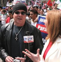
Photo: HNG
Hispanics losing ground on economic development, eventhough Latino voting-age population districts have been redrawn, according to 2010 U.S. Census Hispanic population figures.
By H. Nelson Goodson
April 14, 2012
Milwaukee - Last week Wednesday, a three federal judge panel redrew the boundary lines of two state legislative districts, the 8th and 9th Assembly Districts making the 8th a majority Hispanic voting-age population district. They had ruled earlier, that the Republican control legislature and Governor Scott Walker had violated the voting rights of Latinos when they approved their version of the south side districts.
But in reality, a majority of Hispanics residing in the predominately Latino community, including the few elected public officials in the state legislature (8th Assembly District, State Representative JoCasta Zamarripa (D-Milw.)), Milwaukee County Board of Supervisors (12th District Supervisor Peggy Romo West) and in the Milwaukee Common Council (Newly-elected Alderman José G. Pérez in the 12th District) have yet to give their position on the matter or fully come to realize that the area is rapidly and constantly changing in front of their own eyes.
Supervisor Romo West was just re-elected and didn't address the gentrification issue. She actually doesn't believe a Hispanic district is paramount to get elected, according to an e-mail to Harold Mester, Public Information Manager Milwaukee County. Newly-elected Alderman Pérez will face a challenge with gentrification because it's currently take place in the 12th Aldermanic District and he apparently took part in the South Side Comprehensive Area Plan that was passed in 2009 by the Common Council. The approved plan was considered a boost to gentrification in the south side by residents and business owners. Will these elected officials become front gate keepers for the south side?, and will they be able to stabilize gentrification in their own districts, before it becomes White dominated and face a gradual loss of the Hispanic voting-age population in the future? Time will tell, but will the inevitable gentrification process include Hispanic development as well to keep a balance in the Latino community? Some Latino residents that have moved to Milwaukee from Chicago to escape gentrification say, once the gentrification process begins, greed and economic development takes over minority communities in the name of progress.
Today's effort to maintain a majority voting-age population will eventually become fruitless within the next 10 to 20 years due to economic development disparity triggered by gentrification in the near south side.
Hispanics have been moving South of W. Cleveland and West of S. 43rd Streets in the last ten years, what has been called Hispanic flight from the south side.
In 2009, the Milwaukee Department of City Development created an advisory plan called the South Side Comprehensive Area Plan (SSCAP). On April 2009, members of City Plan Commission chaired by Patricia Torres Najera unanimously decided to approve the controversial SSCAP, despite opposition to approve it. The plan became underfire for the lack of community awareness of the plan, affects, and possible gentrification affect it would have in the predominately Hispanic area. The SSCAP plan included the 12th Aldermanic District and portions of Aldermanic Districts 8, 11, 13 and 14 when it was approved in May 19, 2009 by the Zoning, Neighborhoods, and Development Committee which was Chaired by Alderman James "Jim" N. Witkowiak from the 12th District. That same month, the Common Council approved the SSCAP, as well.
The SSCAP was simply a guide or advisory economic development plan for the south side, which was created by a federal mandate. It was viewed as discriminatory, because those who made the study and finally passed the area plan failed to provide a Spanish version of the plan before it was approved. The plan failed to promote and encourage Hispanic business growth along W. National Ave., W. Greenfield Ave., W. Historic Mithell St., W. Lincoln Ave. between S. 1st to S. 43rd Streets. What the plan actually proposed was retail growth in those particular street corridors.
Also, Historic Mitchell, W. National and W. Lincoln business districts were seen as mix commercial and the plan failed to acknowledge the present Latino businesses or to enhance their growth along these corridors. The SSCAP planners wrote, "the area is home to many new immigrants some are legal and some are illegal." But the plan failed to mention the taxes and revenues generated from the south side district compared to other districts.
The predominately Hispanic south side district is one of the primary districts for generating tax revenue, including fees for licenses, permits, violations, etc., for the City of Milwaukee. The plan cited, “the Near South Side consistently showed signs of robust investment, business, and property value growth. Between 2002 and 2006, sales price per building square foot increased each year and rose from $39 per square foot to $61 per square foot. The annual value of all construction investments increased from $37.8 million to $124.1 million and averaged $56.3 million. The value of land per square foot for residential, commercial, mixed, and industrial use increased and exceeded that for the City of Milwaukee as a whole,” according to the plan market study.
Most of the Hispanic business growth plan was considered on S. Cesar E. Chavez Drive between W. National Ave. to W. Greenfield Ave., according to the SSCAP.
The plan did include a Asian business growth area on W. National Ave. from S. 35th to S. 39th Streets.
Michael J. Maierle, Strategic Planning Manager for the Milwaukee Department of City Development testified before the Zoning, Neighborhoods, and Development Committee hearing in the May 2009 that the area was no longer considered predominately Hispanic. Maierle lacked to show any census or other data to prove that indeed the south side had lost Latino population. But to Maierle, the south side provided “the labor force for most of the metro area.”
In the last 15 years, the Menomonee Valley has been developed economically, but development and the proposed SSCAP would not provide enough jobs needed for the district, according to Carolyn Seboe, HNTB Consulting who participated and compiled the study in 2009.
The SSCAP plan focused on mass development of south side areas that would eventually lead to gentrification, a process of renewal accompanying the influx of middle-class people into deteriorating areas that often displaces earlier poorer residents within the south side. Properties will most likely be sold at below market price and later sold at higher prices making the south side area a marketable land grabbing scenario during the recession.
No doubt, the development plan was considered discriminatory towards new immigrants, low-income residents and Latino businesses along the Historic Mitchell, W. National and W. Lincoln Ave. business corridors
The plan mentioned the growing need to meet housing needs in the south side, and to protect current residents from displacement through gentrification. The plan called for community leaders and the City to establish a Community Land Trust (CLT) in the south side. However, to protect residents from displacement through gentrification was just a recommendation by the planners, instead of making sure the City Plan Commission, the Department of City Development, the City Zoning, Neighborhoods & Development Committee, and the Milwaukee Common Council would establish city legislation or ordinances assuring safe guards to prevent gentrification in the south side.
Today gentrification is flourishing along W. Seeboth, W. Oregon, W. Pittsburgh, W. Florida and from S. 1st St. to the W. Lincoln Ave. area where commercial and residential lofts are on the rise. Other development in the south side has been a housing project on S. Muskego Ave. and W. Mitchell St., including the City purcashing homes along the Kinnickinnic River corridor between S. 6th to S. 20th Streets and demolishing houses to give way for a multi-million flood control project. Developers are proposing to build condominums along the river corridor.
The Third Ward and Walker's Point areas in the 12th Aldermanic District are now called “Yuppie-ville's” and tend to be separate from the rest of the district, which is predominately a Hispanic community. The term yuppie (short for "young urban professional" or "young upwardly-mobile professional") refers to an 1980s and early 1990s term for financially secure, upper-middle class young people in their 20s and early 30s.
The SSCAP plan seems to have led to racial and economic disparity in the south side.
Connected by MOTOBLUR™ on T-Mobile


No comments:
Post a Comment